
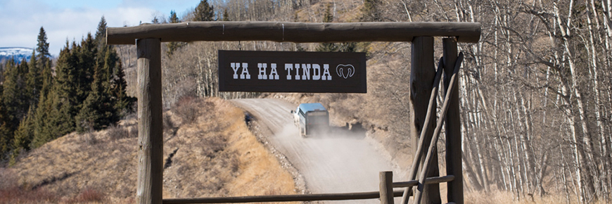
Ya Ha Tinda Ranch trails description
Banff National Park

All trails descriptions start from the Bighorn Campground. Times noted are general travel times without stops.
Banff Park Trail: (map 1)
The main Banff Park Trail is on the north side of the Red Deer River. This trail heads west crossing Bighorn and Scalp Creeks. It's about 13 km to the park boundary. There is an alternate trail to the park on the south side of the river (marked 1a) which involves fording the Red Deer River. The main trail is a novice trail taking 6 hrs round trip.
Scalp Creek Trail:(map 2)
Head west fording Bighorn and Scalp Creeks and follow the trail to a drift fence and gate. Continue NW along the west side of Scalp Creek. Before the next creek crossing you must take an upper cut line trail and get out of the creek bottom. Turn right at next cut line which continues NW. You can follow this as far as you want to go to the upper end of Scalp Creek. Intermediate trail becomes advanced the further you go up Scalp Creek.
Scalp Creek Water Slide:(map 3)
Cool off on a hot day in the Scalp Creek Water slides! Head NW from the campground crossing Bighorn Creek and Scalp Creek following the Scalp Creek Trail. Continue along the creek instead of going up the cut line. You must cross the creek 4 times before you get to the end of the trail where you can tie your horse. Continue on foot walking up the creek to the water slides. Novice to Intermediate trail; 2.5 - 3 hrs round trip.
Well Site Trail: (map 4)
Ford Big Horn Creek and Scalp Creek heading NW on the Scalp Creek trail. You will meet an old road (the old Banff trail). Follow this trail west about 200 meters where it forks south and north west. Take the NW trail leading to the old well site. Novice to intermediate trail; 3.5 hrs. round trip.
Hidden Falls: (map 5)
Travel west along the North side of the Red Deer River approx. 4.5 km to the Hidden Falls fording. Take the trail along the east side of the creek up towards Hidden Falls. Continue until you get to hitching rails. You need to walk down a fairly steep trail to observe the falls. Intermediate trail; 3 hrs round trip.
Wolf Creek/Labyrinth Mtn. Loop: (map 6)
Ford the Red Deer River south of the campground and take the Wolf Creek trail south. This trail follows Wolf Creek east, down to the Red Deer River and main Ya-Ha-Tinda road. The trail crosses the road and parallels it north to Frontier Town, Eagle Lake campground and back to the Bighorn campground. This trip is approximately 20 km with a 500 ft elevation ain with steep terrain. Advanced trail; approx. 8 hrs round trip.
Bighorn Creek/Eagle Creek Low Loop: (map 7)
Cross the road directly north of the campground gaining the hill up Bighorn Creek. Follow the main trail which parallels Bighorn Creek on the east side. The low loop cuts east approx. 1.5 km from the road. This trail proceeds easterly north of a pond. You will reach a ranch east boundary fence with a gate. Continue east and south hitting Eagle Creek where a main trail takes you back west past Frontier Town and to the campground. A new trail bypasses Frontier Town on the west. Novice trip; approx. 3 hrs round trip.
Bighorn Creek/Eagle Creek High Loop: (map 7a)
Cross the road north of the campground following Bighorn creek along the east bank. Continue NE until you reach the ranch north boundary. You then turn east and southeast contouring along the hillside through mixed forest. This joins the lower trail along Eagle Creek and back west towards the campground. Intermediate trip; approx. 4 hrs round trip.
Eagle View Point:(map 8)
Head east along the Red Deer River and follow the trail across the road to the Eagle Lake parking lot. Follow the trail bypassing the YMCA camp on the north side and continue following the trail to Eagle Creek crossing. The trail then heads north, crossing the creek a second time, and heads up a steep hill. The summit is one of the best viewpoints of the area. For return, continue northwest and then west to join the Bighorn Creek trail. Turn back south towards the Bighorn campground. This trail includes some steep switchbacks. Intermediate trail; 1.5 hrs round trip.
Eagle Lake / James Pass:(map 9)
Head east along the Red Deer River and follow the trail across the road to the Eagle Lake parking lot. Follow the trail bypassing the YMCA camp on the north side and continue up Eagle Creek to Eagle Lake. Eagle Lake is approximately 5.5 km, James Pass is approx. 7.5 km Novice trail; 3 hrs for Eagle Lake and 4 hrs for James Pass round trip.
The Sheep Mtn. Loop: (map 10)
Cross the road north from the campground and head up Bighorn Creek. Take the crossing just above the Bighorn Falls, gaining the west side of the creek and the Old Forestry Road. Continue north to the ranch boundary. Head east at trail junction heading to cut-blocks. A blazed trail heading north gains the ridge up Sheep Mountain. You can make a round trip descending on the NW side on an old cat trail joining the Clearwater trail and return (this will take more time). Advanced trail; 8+ hrs round trip.
Related links
- Date modified :