
Combined Northern and Long Range Traverse
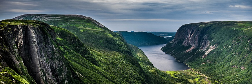
Gros Morne National Park
For a longer backpacking route, combine the Northern traverse and Long Range traverse. Access the Long Range plateau by Snug Harbour and then follow the Northern traverse to the east of Western Brook Pond. Follow the Long Range traverse south across the Long Range plateau towards Gros Morne Mountain before descending into Ferry Gulch. Then return to highway 430 by way of the Gros Morne Mountain trail.
Route Information
There are no trails on the Long Range Mountains. Hiking in the Long Range Mountains should only be attempted by persons who are experienced in backcountry travel and backpacking, have good wilderness navigation skills and are physically fit. For more information on what to expect please review the Hiker Preparation Guide to the Long Range Mountains (PDF, 2.2 MB).
Terrain: Unmarked route; Strenuous
Distance: 60 km
Duration: 5 to 7 days (Hiking times are estimates. Actual times will vary due to weather and ability of hikers. Plan for delays and allow for extra time to complete the hike.)
Access and Exit Points:
Start: Western Brook Pond Trail head
Finish: Gros Morne Mountain Trail head
Operating Season: June 26 - Sept 30
Reservations
- Reservations are recommended. Daily departures limited to 1 group per day with maximum of 4 people per group.
- Important: In order to keep your reservation you must report to the Gros Morne National Park Visitor Centre at 2:30 p.m. the day before your scheduled departure to obtain your backcountry permit.
Two ways to reserve
Trip Planning Information
Hiking in the Long Range Mountains should only be attempted by persons who are physically fit, have good wilderness navigation skills and are experienced in backcountry travel and backpacking. There are no trails on the Long Range. In places you will encounter beaten pathways from previous hikers but they are often indistinguishable from game paths. Route finding can be further complicated when low cloud and other weather conditions reduce visibility. Hikers need to be experienced at navigating unmarked routes.
If nobody in your group has the necessary navigation skills you need to learn and practice them before you arrive or have other hikers with the needed navigation skills join your group.
For more information on what to expect please review the Hiker Preparation Guide to the Long Range Mountains (PDF, 2.2 MB).
Topographic Maps:
- 12H/12 Gros Morne
- 12H/13 St Pauls
- Long Range & Northern Traverse Backcountry Hiking Map (PDF, 6.9 MB)
- Ferry Gulch to Bakeapple Pond Route Description (PDF, 190 KB)
- Hiker Preparation Guide to the Long Range Mountains (PDF, 2.2 MB)
- GPS track files are available for download of the complete Northern Rim and Long Range Traverse (GPX, 319 KB)
WARNING: This file(s) contains information on hiking within GMNP. The file(s) may include GIS data of the hiking areas, or GPS track files of commonly used Long Range routes within Gros Morne National Park. These hiking areas or routes are neither marked nor maintained in any manner by Parks Canada. Weather conditions change frequently. It is the user's responsibility to ensure conditions are safe for travel along these routes at all times. This information was prepared by Parks Canada using its best judgment and information available at the time of preparation. Any use you make of this information and any reliance on or decisions made based on these files are your own responsibility absolutely. Parks Canada, its employees and its agents accept no responsibility for damages, if any, suffered by you or any third party as a result of decisions made or actions based on these maps or files. For greater certainty, under no circumstances whatsoever will Parks Canada, its employees, or its agents be held liable for any loss or damage that may occur to you and any person or persons or property by reason of your or their reliance upon these track files or maps.
- Date modified :