
Northern Traverse
Gros Morne National Park
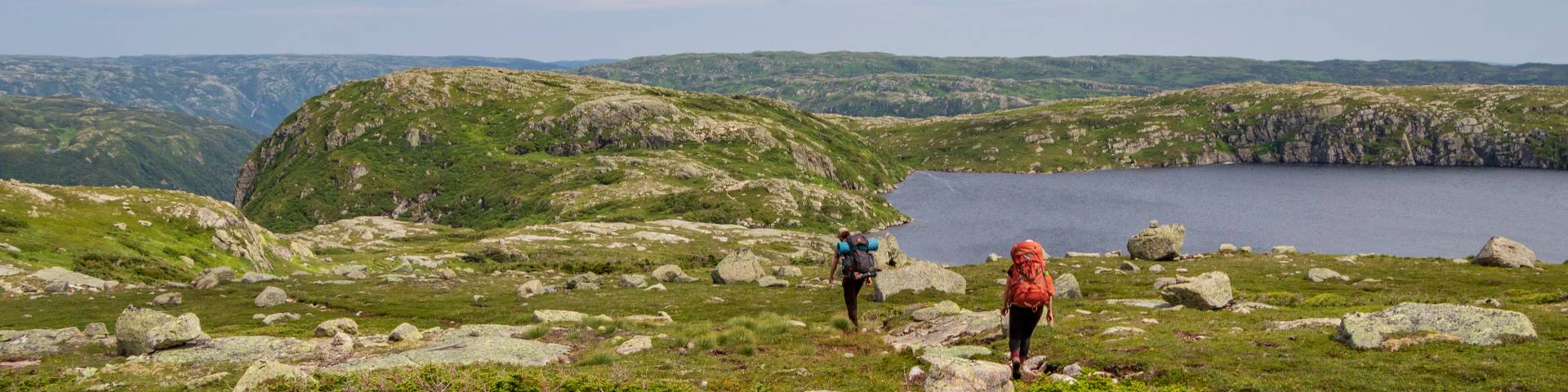
The Northern Traverse is an unmarked and rugged backcountry hiking route. This route starts by climbing onto the Long Range plateau through the rugged gorge at the east end of Western Brook Pond. The route then returns to Snug Harbour and the western end of Western Brook Pond by a westerly route to the north of the pond. The route offers spectacular views of Western Brook Pond only at the eastern and western ends of the hike. The rest of the hike you are travelling the sub-arctic terrain of the Long Range Mountains. The campsites at Gilley Pond and Triangle Pond provide waypoints that help define the route.
Route Information
There are no trails on the Long Range Mountains. Hiking in the Long Range Mountains should only be attempted by persons who are experienced in backcountry travel and backpacking, have good wilderness navigation skills and are physically fit. For more information on what to expect please review the Hiker Preparation Guide to the Long Range Mountains (PDF, 2.2 MB).
Although shorter than the Long Range traverse, the Northern traverse is considered to be more difficult because of its terrain and the large tracts of “tuckamore”[1] that hikers need to navigate around and through. Unlike many portions of the Long Range Traverse, this route does not follow large valleys or have obvious natural landmarks to follow. Hikers should not underestimate the difficulty of this route. This is a route more suited for those hikers looking to experience challenging terrain and testing their route finding skills. GPS trackfiles and waypoints are strongly recommended for this route. Be sure you are proficient using a GPS.
Terrain: Unmarked route; Strenuous
Distance: 27 km
Duration: 3 to 4 days
(Hiking times are estimates. Actual times will vary due to weather, delayed departures of the boat, and ability of hikers. Plan for delays and allow for extra time to complete the hike.)
Access and Exit Points:
To access this route, hikers must take the Western Brook Pond boat tour. Contact Bontours (1-888-458-2016) for reservations and ticket purchases.
Start: Western Brook Pond Trail head
Finish: Western Brook Pond Trail head
Operating Season: June 26 - Sept 30
Reservations
- Reservations are recommended. Daily departures limited to 2 groups per day with maximum of 4 people per group.
- Important: Permits must be picked up at the Gros Morne National Park Visitor Centre at 2:30 pm the day before your reserved start date.
Two ways to reserve
Trip Planning Information
Hiking in the Long Range Mountains should only be attempted by persons who are physically fit, have good wilderness navigation skills and are experienced in backcountry travel and backpacking. There are no trails on the Long Range. In places you will encounter beaten pathways from previous hikers but they are often indistinguishable from game paths. Route finding can be further complicated when low cloud and other weather conditions reduce visibility. Hikers need to be experienced at navigating unmarked routes.
If nobody in your group has the necessary navigation skills you need to learn and practice them before you arrive or have other hikers with the needed navigation skills join your group.
For more information on what to expect please review the Hiker Preparation Guide to the Long Range Mountains (PDF, 2.2 MB).
Topographic Maps:
- 12H/12 Gros Morne
- 12H/13 St Pauls
Download [2]:
- Long Range & Northern Traverse Backcountry Hiking Map (PDF, 6.9 MB)
- Northern Traverse Route Description (PDF 241 KB)
- Hiker Preparation Guide to the Long Range Mountains (PDF, 2.2 MB)
- GPS track files are available for download of the complete Northern and Long Range Traverse (GPX, 319 KB)
[1] Tuckamore – a Newfoundland term for dense stunted forest consisting of mainly spruce and fir. This forest is shaped by the wind into a matted mix of twisted and sturdy tree branches and trunks. It is virtually impassable to hikers.
[2] WARNING: This file(s) contains information on hiking within GMNP. The file(s) may include GIS data of the hiking areas, or GPS track files of commonly used Long Range routes within Gros Morne National Park. These hiking areas or routes are neither marked nor maintained in any manner by Parks Canada. Weather conditions change frequently. It is the user's responsibility to ensure conditions are safe for travel along these routes at all times. This information was prepared by Parks Canada using its best judgment and information available at the time of preparation. Any use you make of this information and any reliance on or decisions made based on these files are your own responsibility absolutely. Parks Canada, its employees and its agents accept no responsibility for damages, if any, suffered by you or any third party as a result of decisions made or actions based on these maps or files. For greater certainty, under no circumstances whatsoever will Parks Canada, its employees, or its agents be held liable for any loss or damage that may occur to you and any person or persons or property by reason of your or their reliance upon these track files or maps.
- Date modified :