
Geology
Nááts'įhch'oh National Park Reserve
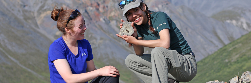
The jagged peaks and curved valleys in Nááts’įhch’oh National Park Reserve provide many clues about the geologic processes that have been at work in Shúhta (Central Mackenzie Mountains) over time.
Sediments and mountain building
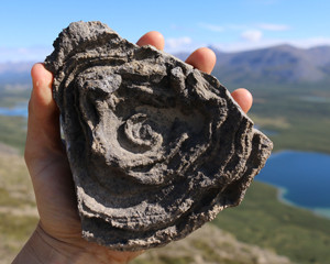
The northeastern branch of the Rocky Mountains, Shúhta’s geological features highlight the range’s early origins and sedimentary history. Fossils of aquatic species indicate that parts of this landscape were once submerged, creating an environment that preserved the bodies of ancient organisms within fine-grained sediments. Among the most important fossil finds in the park, fish specimens dating from the Devonian period (approximately 400 million years ago) have helped palaeontologists to understand how teeth evolved in vertebrate animals. Sedimentary rock layers were later warped and uplifted, creating the mountains you see today. The processes responsible for pushing this region upward remain under study by geologists; this is a rare case of a major mountain building event that is far from the nearest boundary between tectonic plates in the earth’s crust.
Glaciers and permafrost
Snow and ice have also played a part in sculpting this landscape. U-shaped valleys are some of the most visible evidence of glaciation, showing how moving ice has scoured away rock and sediment. Although the massive glaciers of the last ice age have long receded, alpine glaciers can still be observed on the park’s peaks today. These slowly moving sheets of ice and rock are responsible for features like tarns, arêtes, and moraine deposits.
Permafrost also modifies the landscape in different ways. Nááts’įhch’oh National Park Reserve has discontinuous permafrost, meaning that soil layers are frozen year-round in some places but not in others. Soils expand and contract when they go through freezing and thawing cycles, producing distinctive landforms like pingos (ice-cored mounds) and hummocky areas patterned with polygon shapes. Climate change has also caused some permafrost areas to melt, reducing soil stability. These areas are evidenced by, for example, so-called “drunken forests” (trees tilting at different angles) and slumps of wet soil.
- Date modified :