
Kimberley Meadows
Kluane National Park and Reserve
Trailhead: 20 km (12.5 mi) north of Haines Junction on the Alaska Highway, 2.2 km (1.4 mi) north of the Spruce Beetle Trailhead.
1:50 000 Topo maps: Auriol 115A/12 / Kloo Lake 115A/13
Download the Kimberley Meadows route description (PDF, 197 Kb)
A route is not a trail
Routes are not marked with signs or maintained in any manner. The routes described here are only suggestions that may help guide you on your trip. Self-reliance and wilderness travel experience are essential, including excellent route finding skills, map and compass skills. It is the responsibility of individual hikers who choose to follow such routes to adequately prepare and be prepared to rely on themselves.
Route options
-
Kimberley Meadows return
Distance: 38.8 km (24 mi) return trip
Time: 3-4 days
Elevation gain: 1,003 m (3,290')
Maximum elevation: 2,000 m (6,562’)In summary
This route starts at Bear Creek Summit and follows the Mt. Decoeli route until the pass; it then descends the rock glacier to the northwest, traverses above a valley turning southwest to a small alpine lake and south across a rock glacier to Kimberley Meadows.
The details
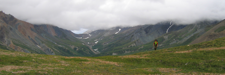
The route begins from a parking area on the west side of the highway just 2.2 km north of the Spruce Beetle Trailhead. Follow the new trail cut from the parking lot to Summit Creek (about 1 km). The route then follows the creek staying on the south (left hand) side during the lower section with occasional shortcuts along dried up stream channels. You may choose to cross the creek, however during high water it may be best to stay to the left and cross the creek at the base of the rock glacier.
From the toe of the rock glacier, the route follows the creek to the right along the north side of the rock glacier. To the north (right) lies an alpine meadow with numerous scattered boulders. These boulders are home to a colony of hoary marmots. There is a trail that climbs up on the meadow. You can either follow that trail for a short section and then drop down again or stay low. Continue along the rock glacier past a temporary creek that comes off the south side of Mt. Decoeli and past a small ridge. Here the route climbs northwest to a pass between Mt. Decoeli and an unnamed peak to the southwest. The weather can often be wet up here.
From this pass the route descends northwest, following the right side (or right creek) of the rock glacier. At the toe of the rock glacier, veer west (or left) remaining above the willows and traverse around the mountain 3-4 km until an alpine lake comes into view. It is possible to walk in the meadows below, however it is often quite wet, and may take longer. The alpine lake is at UTM LC 380 472; this is a possible camping area. Looking south from the lake another rock glaciers waits. There is a ramp flowing out of the glacier (from the left as you are looking at it) that provides for easy access onto the glacier. The glacier is slightly more than 1 km across, and the view of Kimberly meadows from above is impressive. Kimberly Meadows is a great place to camp; there are an abundance of flat tenting spots, and fantastic views. Water may only be available earlier in the summer. From here you may turn around or continue on to the following route.
-
Kimberley Meadows to Alsek Valley route
Distance: 59.4 km (37 mi) loop
Time: 4-5 days
Elevation gain: 832 m (2,730’)
Maximum elevation: 1,476 m (4843’)In summary
From Kimberley Meadows the route heads southeast over another rock glacier (Kimberley pass) and descends to the headwaters of Ferguson Creek. From here the route crosses the valley and descends an unnamed creek to the east of Ferguson creek to join up with the Alsek trail. This route begins and ends outside Kluane National Park and Reserve (the first 15 km and the last 6 km).
The details
Kimberley Meadows to the headwaters of Ferguson (Sugden) Creek: Head southeast down the meadows and cross Kimberley Creek where it emerges from the toe of the rock glacier, then head south (right) along the glacier, gaining elevation gradually to get on the rock glacier. From here walk for 1km south-east down the glacier. As you approach a large depression in the centre of the rock glacier veer east (left) and travel along this side. You will pass two glacial melt lakes on your way to Ferguson Creek headwaters. The headwaters of Ferguson Creek provide great camping possibilities. From this point it is advisable to plan your route for the next day. The next section of the route is long and demanding, during bad weather, consider returning the way you came.
Ferguson Creek headwaters to the Alsek Trail: Looking down the valley, you will eventually want to arrive at the saddle to the east (left) of the prominent pointy looking knoll (UTM LC 439 332) at the end of the valley. From here you have two options:
Option 1: Take note of the features of the drainage that you need to take in order to arrive at the saddle mentioned above so you will remember it from down in the creek bed. Follow Ferguson Creek until you come to the very drainage that will take you up to the saddle. There are a few bushy sections along the way but they are short. Remember to make lots of noise when going through these sections as the creek is quite loud, too.
Option 2: Continue down Ferguson Creek about 2.5 km, until red rock appears on the west (right) walls of the creek. From here there is a gradual bench that descends to the creek from the east (left). It has less willow coverage than other hills in the area, and makes for a great point to climb up and above the willows. From here stay as high as possible above the willows and gradually make your way to the knoll. You will have to descend and ascend three to four large steep ravines that require special attention. Make lots of noise through this section, as you do not want to surprise a bear in the willows.
Once at the pass, there is opportunity to climb the knoll to your right, it provides 360 degrees of spectacular landscape, and makes a great lunch spot. From the pass descend following the creek south (on the map this creek is the first creek east of Ferguson Creek, it is unnamed). The descent is easy going for 1 km, in high water there may be a few tricky sections getting around rocky steep areas. At elevation 750m, the willows and alders become thicker, and the snags more abundant. The last 2 kilometres of the descent are slow going – it requires crossing over or under a substantial number of dead white spruce snags overlying the creek. Special attention should be paid not to rush this section. It is slippery in places. Once at the Alsek trail you are home free! Camping is good near where the creek you followed enters the Kaskawulsh River; there is an abundance of flat space, and clear water nearby.
From Unnamed Creek east of Ferguson Creek to the start of the Alsek Trail: From here it is an easy stroll down the Alsek trail. Walk for 7 kilometres along an old road to the park gate; watch for a well-used bear stomp on your right. At the park gate you are 15.4 km from the parking lot. From this point, the trail you follow is a four-wheel-drive access road that makes a great bike trail as well. Caution: when the water is high, it is impassable by vehicle.
What you need to know
Sturdy hiking boots are a must for side hilling, rock glacier traverses, and creek walking. Water is relatively abundant throughout the route. Binoculars are useful for observing distant mountains and wildlife viewing.
For all overnight trips in the park Approved Bear Resistant Food Canisters are mandatory and a Wilderness Permit is required, both can be obtained from the Kluane National Park and Reserve Visitor Centre in Haines Junction or at the Thechàl Dhâl Visitor Centre. For more information: Overnight Registration.
Bear sightings are very common in this area. Review recommendations for travel within the You are in Bear Country brochure. The use of bear resistant food canisters is mandatory since you are passing through a portion of the Alsek Valley. All bear sightings should be reported to the staff at one of the Visitor Centers.
Parks Canada 24 hour emergency dispatch
1-780-852-3100
Cellular telephones do not work in most of the park. Satellite phones or satellite messaging devices are strongly recommended.
Related links
- Date modified :