
Draft management plan
Kluane National Park and Reserve
Draft Management Plan
Kluane National Park and Reserve of Canada
May 25, 2022
Title: Kluane National Park and Reserve of Canada Draft Management Plan, May 25, 2022
Organization: Parks Canada Agency
Table of contents
Maps
Recommendations
Recommended by:
Ron Hallman
President and Chief Executive Officer
Parks Canada
Andrew Campbell
Senior Vice-President, Operations
Parks Canada
John Haselmayer
Acting Field Unit Superintendent,
Yukon Field Unit
Parks Canada
Linaya Workman
Park Manager,
Kluane National Park and Reserve
Parks Canada
Dän nätthe äda Kaaxnox,
Chief Steve Smith
Shadhäla yè Ashèyi Kwädän
Champagne and Aishihik First Nations
Bob Dickson
Chief
Lhùʼààn Mân Kwa Chʼânʼ
Kluane First Nation
Elsabe Kloppers
Chair
Kluane National Park Management Board
Vision
This is a living land; this is Dań Keyǐ, the People’s Country.
This is a place of healthy water, plants, animals and people, resilient in the face of a changing climate.
This is a home for sharing knowledge and reconnecting.
This is a place where wise decisions are made together and all knowledge is valued and considered.
This is a place where we all feel welcome.
Ä́’sía Keyi — Grandfather's Land
Ä́’sía keyi,
nedį́shį̀ka dak’anuta du.
Ä́’sía keyi,
dach’anakwats’ä`n diyą
ughą yats’a säy na.
Ä́’sía keyi, nakwats’än diyą
äju yats’a säy, ak’an.
Ä́’sía keyi,
nakwanich’i ū
A’hų tashäníthį.
Kwänischis yadįnį.
Grandfather’s country,
you take care of us.
Grandfather’s country,
you were taken from us
and we cried for a long time.
Grandfather’s country,
you came back to us
and we don’t cry anymore.
Grandfather’s country,
we are happy to see you again.
Thank you for everything.
Däzhän Dákwändür Ch’e — This is our story
Kluane National Park and Reserve (Kluane NPR or “the park”) lies in the southwest corner of Yukon and protects a spectacular landscape of high mountain peaks, massive valley glaciers, boreal forests, northern wildlife, and rich cultural heritage.
In Southern Tutchone, the land is known as Dań Keyǐ /the People’s Country. The Kluane region has been home to Dän/The People for thousands of years and their knowledge is based on an interconnected relationship to the land. Dän lived as part of the natural cycles and their stewardship, based on generations of knowledge, has enriched the health of the land.
Many of the vital connections that Dän had to this place were severed when the Alaska Highway was built in 1942. In a misguided effort to protect wildlife along the highway, the government established the Kluane Game Sanctuary in 1943. With the stroke of a pen, Dän were evicted from their homeland – they could no longer live off the land by hunting and trapping. With the removal of Dän from their lands, the health of the land and people declined.
In 1973, a delegation of Yukon First Nation Chiefs presented the document “Together Today for our Children Tomorrow” to then Prime Minister Pierre Elliot Trudeau, which started land claims negotiations in Yukon. In 1976, Kluane NPR was declared a national park reserve to protect a representative area of the Northern Coast Mountains Natural Region. The Government of Canada signed comprehensive land claim Final Agreements with Champagne and Aishihik First Nations (CAFN) and Kluane First Nation (KFN) in 1993 and 2003, respectively.
The rights of the Lhùʼààn Mân Kwa Chʼânʼ/Kluane Lake People and the Shadhäla yè Ashèyi Kwädän/Champagne and Aishihik People to hunt, trap, fish and gather plants in the park are defined in their Final Agreements and are protected under the Constitution of Canada. These modern-day treaties are the legal foundation for the cooperative management of Kluane NPR, built upon a relationship of trust, mutual respect and shared values.
The Kluane Lake People and the Champagne and Aishihik People have been working to revitalize their culture through reconnection. Being on the land, re-establishing family connections, teaching traditional activities, revitalizing language, and creating a sense of belonging for new generations are priorities. A Nation-to-Nation initiative called “Healing Broken Connections” began an important healing process between the Federal Government and the First Nations.
Together, the Kluane National Park Management Board, KFN, CAFN and Parks Canada protect and care for this special place – for today, and for generations to come. As stewards, First Nations voices are an integral part of decision making, bringing vital insights into caring for the land that are based on generations of knowledge. This plan was created by the cooperative management partners to guide the management of the park for the next 10 years. The partners will report annually on progress toward achieving the plan objectives. The plan will be reviewed every 10 years or sooner, as required by legislation.
Guiding principles
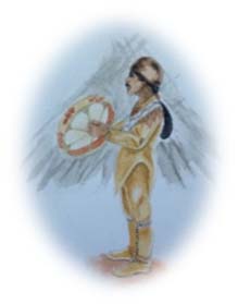
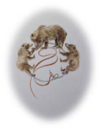
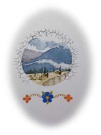
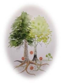
These values were identified by the cooperative management partners to provide guidance in the management of Kluane National Park and Reserve. (Artwork: Frances Oles; translation: Chughäla (Lorraine Allen) and Ayedindaya (Margaret Workman)
Kwiyaajàl’ — Welcome
Kluane National Park and Reserve is a place for everyone, a place to learn and experience, and a place where connections can be made.
Drums are a voice, of stories, celebration or sadness. Drums welcome, invite dance or bookend stories. Each drum has its own voice and together they speak for a time and place.

Nàts′įt′är — Respect
It is important to listen to and learn from each other so we can build strong relationships, trust each other and work together for our common goals.
A long time ago, it was a chaotic time in the world of animals. Beaverman organized the animals so they all had their own niche in the world and could interact and live with one another in a way that benefited all, over time.
Kwädäy kwändür jenītth’a k’e kīdän — We listen and learn the long ago teachings
Sharing our knowledge is a circular process from Elder to youth and is based on generations of experiences that can be passed on to our future leaders.
A mother bear teaches her young how to thrive and survive in the world. This knowledge is passed on, generation to generation. The feather snare makes a background circle and represents traditional knowledge and technology. It is made of simple resources, but its application is effective. It is fragile, yet portable and replaceable.
Dazhän nän käy yè dàkeyi dághàshǖr tʼų̀ ghàkwīnjì — We are all thankful for our land, it gives us all that we need for life
Every thing is connected and our strength and resilience comes from our connections to our land and water. We must work together to ensure that those connections remain to support a healthy environment and people.
A watershed. The air and mountains create a landscape that permits plants, animals and people to thrive. The mycelia encircling the landscape represents interconnectedness that nurtures. The bead floral design represents people and balance.
Nłaye uk′anįthät — You people, you are thinking about it together
We guide our decisions by using land-based traditional knowledge and scientific information to form one vision.
The two trees are separate species yet they support each other. The ochre circles represent human ideas and tradition. There are four, indicating the four directions. The sprout represents new ideas that come from sharing.
Shäwthän kuk΄àts΄änätà däzhän nän kay — Everyone look after the land very well
As caretakers, we have a responsibility to ensure that our decisions reflect our values and that the connections between the land, the water and the people who live here remain forever.
Our hands on the land represent care and intent.
Significance
Since the last Ice Age, Southern Tutchone people have lived in the area that is now Kluane NPR. Throughout the year, families travelled great distances to take advantage of seasonal abundances of wildlife and plants. Over 250 archaeological sites directly related to Southern Tutchone people have been identified in Kluane NPR and the park encompasses a network of heritage trails interwoven with Indigenous place names. Dän strive to rebuild and maintain their deep cultural and spiritual relationship to the land as their ancestors have for millennia – teaching their youth, hunting and gathering, and passing on the stories of their country.
Kluane NPR is part of a UNESCO World Heritage Site, along with its neighbours Wrangell-St. Elias and Glacier Bay National Parks in Alaska, and British Columbia’s Tatshenshini-Alsek Provincial Park. Together, these parks form one of the world’s largest internationally protected areas. In 1986, the 90-km portion of the Alsek River that flows through Kluane NPR was designated a Canadian Heritage River. The river is recognized for its impressive natural features, 10,000 years of cultural history, and world-class wilderness rafting.
The characteristics that define this part of the Northern Coast Mountains Natural Region include:
- the St. Elias Mountains, including Mount Logan, Canada’s highest peak at 5,959 meters;
- one of the largest non-polar icefields in the world, with immense valley glaciers and wild rivers – a vestige of the last Ice Age;
- the most genetically diverse population of grizzly bears in North America, a significant population of Dall’s sheep, and the only land-locked kokanee salmon population in a Canadian national park; and
- an ecological crossroads of Pacific Ocean influences, the Arctic and the boreal forest resulting in diverse vegetation communities.
Kluane NPR is known worldwide for its outstanding recreation opportunities, attracting mountaineers, white-water rafters and experienced hikers to its mountainous terrain and icy blue rivers. Visitors also come to experience the engaging exhibits at the park visitor centres, drive the picturesque Alaska Highway, take strolls and day hikes, view wildlife, and share peaceful moments with friends and family.
Kwiyaajàl’ — We are happy to welcome you.
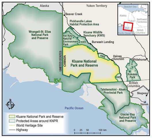
Map 1: Regional setting — Text version
This is a map showing the regional setting for Kluane National Park and Reserve. The geographical extent includes south-western Yukon, north-western British Columbia, and south-eastern Alaska. From north to south, the locations of the settlements of Beaver Creek, Burwash Landing, Haines Junction, Whitehorse, Skagway and Haines are indicated on the map. There is a legend at the bottom left corner of the map, identifying the following:
- Kluane National Park and Reserve
- Protected Areas around Kluane National Park and Reserve
- World Heritage Site
- Highway
Kluane National Park and Reserve is situated in the south-western corner of Yukon and is surrounded by Wragell-St. Elias National Park Reserve, Asi Keyi Natural Environment Park, Kluane Wildlife Sanctuary, Kusawa Park, Tatshenshini-Alsek Provincial Park and Glacier Bay National Park and Preserve.
Planning context
Final Agreements
The “Champagne and Aishihik First Nations Final Agreement” (1993) and the “Kluane First Nation Final Agreement” (2003) identify rights and responsibilities for First Nations members and Canada, including:
- re-affirming First Nations rights within the park;
- recognizing the traditional and current use of the park;
- ensuring Southern Tutchone language is used in the park;
- providing economic and employment opportunities for First Nations members in the development, operation and management of the park; and
- using traditional and scientific knowledge in park management.
Self-government Agreements
The “Kluane First Nation Self-government Agreement” (2010) and the “Champagne and Aishihik First Nations Self-government Agreement” (1993) recognize the inherent right of self-determination and outline the legislative authority on topics such as:
- governance, and the management and administration of rights and benefits for First Nations citizens;
- developing social, educational and economic services for First Nations citizens; and
- enacting laws on their settlement land pertaining to resource use and management, harvesting, and licensing and regulating of activities that may occur on settlement land.
Cooperative management
A new era of cooperative management began with the signing of the Final Agreements. Parks Canada, KFN and CAFN are engaged in an enduring effort to look after the land, based on strong mutual respect and a shared understanding of respective responsibilities. The Kluane National Park Management Board (“the Board”), mandated in both Final Agreements, is a key to cooperative management and may make recommendations on all matters pertaining to the development and management of the park, including revisions to the park management plan. The Board is comprised of six voting members: two nominees of CAFN, two nominees of KFN and two nominees of the Government of Canada. The park manager sits on the Board as a non-voting member. The Board’s Strategic Plan (2021-2024) identified four goals:
- Nighą shäw nīdhän dákéyi łàádal yu — We are happy to have you come into our country. This goal is focused on strengthening relationships and making connections. Following the lead of the First Nations, help to create space and opportunities to incorporate Traditional Knowledge in all aspects of discussion and recommendations.
- Däzhän kʼe ndasädiíye — This is the way we work. This goal is focussed on actively fulfilling the mandate of the Board as outlined as outlined in the CAFN and KFN Final Agreements.
- Shadä̀tthʼi kʼè sòthän ghàkenädän — They all learn well sitting in a circle. This goal is focused on building a strong and effective Board, advancing its capacity through streamlining internal processes and educating external communities.
- Dän tsʼän kwíshe kʼè sòthän jennítthʼą — When I talk to people, I understand well. This goal is focussed on enhancing communications and engagement by meeting people where they are at.
Realignment of the park and park reserve boundaries
Parks Canada is working to realign the boundary of Kluane NPR in certain areas.
- When Kluane National Park Reserve was established, the boundary along the Alaska and Haines highways was set back 305 m, to allow for future realignment of the roads. The highway realignments have now been completed and the administration and control of these lands has been transferred to Parks Canada for eventual inclusion into the park and park reserve. These areas include strips of land that parallel the highway from Khàr Shan Nij/Congdon Creek to ’A’ä̧y Chù’/Slim’s River and from Bear Creek to Łu Ghą/Klukshu River.
- Consistent with the Final Agreements, the legal boundary will be corrected to reflect KFN and CAFN settlement lands that were removed from the park and park reserve.
Zoning changes
Several changes to park zoning are set out in this draft management plan. Zoning changes were made to: 1) incorporate new information about ecosystem protection requirements, and the ecosystems’ capability and suitability to provide opportunities for visitor experiences, and 2) confirm and identify visitor experiences that are consistent with ecosystem protection requirements. One zoning change is identified to accommodate the proposed KFN eco-tourism facility. Two zoning changes are identified to accommodate the proposed CAFN eco-tourism facility. These eco-tourism facilities are rooted in the two Final Agreements, which speak to economic benefits for First Nations from the operations and development of the park. All zoning changes (and the management plan in total) were subject to a Strategic Impact Assessment, which concluded that zoning changes and corresponding potential activities are consistent with the park’s ability to uphold ecosystem protection requirements (see 8.0 Summary of Strategic Environmental Assessment). Eighty-five percent of the park remains Zone II (Wilderness). This percentage has not changed from the 2010 management plan. These and other zoning changes are described in detail in Section 7 — Zoning, and in the “Rationale for Changes to Zoning - Kluane National Park and Reserve Draft Management Plan (2021)” document, available at: www.pc.gc.ca/en/pn-np/yt/kluane/gestion-management.
First Nations economic benefits
The Final Agreements outline specific and general approaches to economic opportunities in the park for both CAFN and KFN. KFN is moving forward with a proposal to develop an eco-tourism facility in the park, near Bighorn Lake. A main lodge and cabins would accommodate tourists and staff for multi-night stays. Associated rudimentary cabins, that are consistent with Zone II, may also be established. CAFN is moving towards developing an eco-tourism facility on their settlement land outside of the park, beside Mät’àtäna Män/Kathleen Lake, with many of the proposed activities to occur in the park. Supporting infrastructure in the park may include two mountain camps located on high points, one between Mush and Bates lakes and one between Sockeye and Johobo lakes. Associated rudimentary cabins, that are consistent with Zone II, may also be established. Activities for both developments may include: experiencing Southern Tutchone culture, aircraft–assisted wildlife viewing and hiking, flight-seeing, cross-country skiing, horseback riding, and dog sledding. Both of the proposed projects are at a conceptual stage.
“Reserve” status
The “reserve” status of Kluane National Park and Reserve will be removed when White River First Nation and the Government of Canada enter into a Final Agreement.
Rapidly changing natural environment
The Kluane region is warming; the mean annual temperature in the Village of Dakwäkäda/Haines Junction has increased by 4°C since 1945. This has caused the loss of over 230 small glaciers and 19% of the total area covered by glaciers. In 2016, the retreat of the Kaskawulsh Glacier caused the diversion of a river into a different watershed and ocean, bringing immense landscape change. Climate change models predict further impacts in the region, including lengthening of the fire season, more rain-on-snow events, and increasing lake temperatures. Species and ecosystems may not be able to adapt to this rate of change.
Pressures adjacent to the park
Issues of concern in the Kluane region, which could adversely impact the park’s natural and cultural resources and values, include:
- increased discharge of treated sewage effluent from Dakwäkäda/Haines Junction into the Shadhäla Chù/Dezadeash River wetlands;
- increased mining development; and
- the potential for wood bison to expand their range into the park.
Findings of the State of the Park Assessment
The “Kluane National Park and Reserve State of the Park Assessment” (2017) identified three key issues:
- The need to further improve relations with First Nations and increase the use of traditional knowledge and Indigenous languages.
- The need for a more strategic approach to visitor experience management, including greater use of social science to help understand visitor use patterns, help identify strategic markets, and support the development of a visitor use plan.
- The need for more attention to, and research on, key ecological issues with highly visible impacts. Of particular importance over the life of this plan are: 1) the diversion of the ’A’ä̧y Chù’/Slim's River; 2) slow recovery from an unprecedented spruce bark beetle outbreak; 3) poor forest health and the need for a restoration plan that will improve ecosystem health and decrease the risks associated with high fuel loads and wildfire; and 4) potential recovery of a kokanee salmon population thought close to extinction.
Visitation changes since the 2010 plan
In 2012, the Da Kų Cultural Centre was built by CAFN in Haines Junction. This facility houses a Parks Canada Visitor Centre and Yukon Government Information Centre, offering visitors an excellent place to begin their visit. In 2019, the Thechàl Dhâl’ Visitor Centre was renovated and new exhibits developed, providing visitors with opportunities to engage with local First Nations people, culture and language. Since 2010, a significant decrease in organized tours has been met with an increase in independent travellers. The number of backcountry hikers and the number of campers at Mät’àtäna Män/Kathleen Lake campground are increasing and some activities are gaining in popularity, such as pack-rafting and cycling. In 2018, five oTENTiks, a Parks Canada brand of alternative accommodation, were built at Mät’àtäna Män/Kathleen Lake Campground, offering a new visitor opportunity. Interpretive programs, special events and school programs have been increasing in recent years.
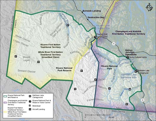
Map 2: Kluane National Park and Reserve — Text version
This is a map detailing the area within Kluane National Park and Reserve. The geographical extent includes south-western Yukon, north-western British Columbia, and south-eastern Alaska. Sites indicated outside the park boundary are listed as Burwash Landing, Destruction Bay, Champagne and Aishihik First Nation Tradition Territory and Haines Junction Dakwäkäta. There is a legend at the bottom left corner of the map, identifying the following:
- Kluane National Park and Reserve
- Aishihik First Nation Tradition Territory
- Kluane First Nation Tradition Territory / White River First Nation Traditional Territory (Unsettled Claim)
The legend also outlines the following icons appearing within the Kluane National Park and Reserve boundary:
- Kathleen Lake Campground
- Kluane National Park and Reserve Visitor Centre
- Motorboat
- Aircraft Landing
Development of the draft management plan
This draft plan was co-developed by a working group made up of members of the Kluane National Park Management Board, Champagne and Aishihik First Nations, Kluane First Nation and Parks Canada. Operating under the Board’s mandate. Several meetings of the working group were held to design the planning process and the approach to consultation, and to co-develop the plan content.
An initial round of consultation was held in June, 2019 as the draft plan was being developed. A newsletter was circulated broadly and placed on the Kluane National Park and Reserve-Parks Canada web page to support this round of consultation. The newsletter contained a draft vision for the park and reserve, and a series of questions related to park management. Public open houses were held in Haines Junction, Burwash Landing and Whitehorse. Meetings were held with Elders from CAFN in Haines Junction, and with Elders from KFN in Burwash Landing. Parks Canada staff met with representatives from Yukon Tourism and the Canadian Parks and Wilderness Society. A “What We Heard” report was produced in January, 2020 which summarized the results of consultation. These results were considered by the working group as the draft plan was being prepared.
The second and final round of consultation will focus on review of this draft plan. The draft plan and a newsletter will be circulated broadly and placed on the Kluane National Park and Reserve-Parks Canada and the Government of Canada “Consulting with Canadians” web page. Public open houses and meetings are planned for several local communities. All comments received will be considered by the Board as the management plan is finalized.
Goals, objectives and targets
Management of Kluane NPR for the next 10 years will be based on the following goals and objectives. The goals outline high level direction and the objectives describe priorities in support of each goal. Targets allow measurement and reporting on progress towards each objective. Annual work plans will be based on the guidance provided in this plan.
Goal 1
Dań k’è kwǎnjì’/The People’s way is alive
After decades of exclusion from Kluane NPR, Dän are re-establishing their presence in and connections to the park. This goal addresses the ongoing need to support Dän in rebuilding a strong and enduring relationship to the park, with a focus on engaging youth and future leaders. Parks Canada, CAFN and KFN will work together to identify barriers to reconnection and implement solutions. The revitalization of Southern Tutchone culture is strongly supported through the implementation of the CAFN and KFN Final Agreements.
Objective 1.1
Revitalize Southern Tutchone culture and traditions.
Targets
- Dän are practicing and living their culture in the park – carrying out traditional activities such as camping, harvesting and holding cultural camps, reconnecting to cultural areas, and teaching new generations.
- A cultural resource management approach that includes an inventory of known resources, management objectives, and actions, has been completed within five years.
- Parks Canada, CAFN and KFN work together to establish a Guardian program in the park.
Objective 1.2
Parks Canada, CAFN, and KFN collaborate to meet obligations set out in the Final Agreements.
Targets
- The history, culture and rights of First Nations are recognized in the operations of the park.
- Parks Canada has facilitated economic and employment opportunities related to the management of the park, including the establishment of the proposed CAFN and KFN eco-tourism facilities.
- Indigenous and scientific knowledge are interwoven, and guide park management.
Goal 2
Dákeyi ukaanathį̀ jè/All of you watch over our country with your heart
This goal focusses on maintaining and improving the ecological integrity of ecosystems and the need to build resiliency for rapidly changing environments as a result of climate change. Management decisions will be founded on Indigenous, local and scientific knowledge. Research partnerships, First Nation knowledge-keepers and youth involvement are key elements. Dän cultural values toward land management are honoured and shared, and the traditional activities of Dän on the landscape are recognized as contributing to ecological integrity and the health of the land. These activities are recognized and reflected in park management. Through this, biodiversity and ecological integrity are enriched
Objective 2.1
Dásìa keyi ukaanáthį̀ jè/You look after our grandfathers’ country from your heart.
Targets
- A fire management plan that provides strategic direction on fire management activities, including the use of fire for cultural, ecological and risk reduction purposes, has been developed within five years. The plan outlines planning and operational priorities and incorporates traditional practices into the following core elements: wildfire prevention, wildfire risk reduction, wildfire preparedness, wildfire management and response, and prescribed fire implementation.
- Agreements with neighbouring governments to manage and minimize the impact of wildland fire on resources in and outside of the park are in place within three years.
- A management strategy to address potential adverse environmental and cultural impacts of wood bison has been developed within five years. The management strategy considers options to mitigate and reduce the risk of expansion of the population.
- There is no expansion of new and existing terrestrial invasive species in the park.
- Monitoring of the Duke River moose population is providing useful information on the health of the herd.
- A landscape management unit approach, which minimizes cumulative disturbance to grizzly bears has been implemented within five years. This approach includes a strategy to assess and manage aerial disturbance and landings in the park.
Objective 2.2
Chu ukaanáthį̀ jè/You look after the water from your heart.
Targets
- Awareness of Dän cultural values toward water management, including ceremonial aspects, has increased.
- Understanding of kokanee salmon has improved, and their population is resilient.
- Lake trout populations in Mush, Bates and Mät’àtäna/Kathleen lakes remain resilient (i.e. within +/-1 standard deviation of the baseline catch-per-unit effort).
- Shadahäla Chù/Dezadeash River water quality remains high.
- There are no aquatic invasive species or diseases in the park.
- 70% of park anglers demonstrate awareness of their role in preventing the spread of invasive species.
Objective 2.3
Species at risk are looked after.
Targets
- An inventory of the distribution of newly listed species at risk in the park has been completed.
- A multi-species site analysis has been completed within two years.
Objective 2.4
Management approaches recognize the impacts of climate change and address potential emerging issues.
Targets
- Vulnerability and risk assessment tools are being used to identify impacts and prioritize adaptation options.
- Greenhouse gas emissions from park facilities (i.e. heating fuel and electricity consumption) and vehicles (i.e. fuel consumption) will be tracked and reduced from 2020 levels, in-line with Parks Canada’s national commitment.
- Non-climatic stressors have been reduced to increase species’ resilience to climate change; in particular sheep mortality along the Alaska Highway is reduced within five years.
- There is greater collaboration with partners and researchers to tackle complex problems and emerging issues, and to increase public awareness.
- Youth have been involved in at least one monitoring activity every year.
Objective 2.5
The values upon which the park’s World Heritage Site (WHS) and Canadian Heritage River System (CHRS) status are based, are intact.
Targets
- Collaboration and communication amongst WHS and CHRS partners has improved.
- The 10-year monitoring report for the Alsek River has been completed within eight years.
- First Nations history, culture and rights are highlighted in information about the WHS and CHRS designations.
Goal 3
Kwiyaajàl’/We are happy to welcome you
This goal focusses on creating opportunities for visitors with a range of abilities, interests and identities to learn about, experience and care for the park. There is a need for better information and a strategic approach to provide a high quality suite of visitor experiences, while minimizing impacts to ecological and cultural values. Visitor experience planning tools will be used to achieve this goal. The tools will help identify target markets, and the appropriate experiences and products the park could offer to help meet market demand.
Objective 3.1
Improve understanding of current and future park visitors.
Targets
- The types of current visitors and their activities are known as a result of improved tracking systems.
- Strategic target markets and tourism development opportunities have been identified.
Objective 3.2
Provide visitors with opportunities for high quality experiences that are tied to target markets’ needs and desires.
Targets
- Partnerships with tourism organizations, stakeholders and businesses, to promote the park and explore new visitor opportunities, have expanded.
- Visitors and local residents feel welcome and their interests are reflected in the review of new recreational activities and access points.
- Park users have access to information about avalanche exposure and other risks to help them make informed decisions about where to recreate, within three years.
Objective 3.3
Manage visitor use to minimize ecological impacts, while maintaining high quality visitor experiences.
Targets
- The impacts of backcountry visitor use, including those from biking, hiking and aircraft, are monitored, assessed and mitigated.
- Visitor management approaches for the ’A’ä̧y Chù’/Slim’s River Valley have been revised as part of an overall visitor use plan.
- Access to mountaineering opportunities in the Icefields region is strictly controlled in order to maximize the safety of visitors and staff and minimize the likelihood of rescue.
Objective 3.4
Maintain or increase visitor satisfaction.
Targets
- Visitors with a range of abilities, interests and identities at the two key points of contact (Thechàl Dhâl’ and Haines Junction) report general enjoyment and satisfaction with their visitor experience.
- Interpretive exhibits and signage have been refreshed and incorporate traditional names.
- An asset management strategic plan is developed by 2025.
Objective 3.5
Dän cultural values and belief systems are integrated into the visitor offer.
Targets
- Parks Canada, KFN and CAFN are working together to appropriately share Dän stories.
- Dän are in the park, sharing their stories and traditions with park staff and visitors.
- Signs and visitor materials contain Southern Tutchone and opportunities for park staff to learn Southern Tutchone language have increased.
- Visitor awareness of the importance of Dän harvesting and cultural activities has increased.
Goal 4
Dándāl dákundür hį/We will tell you all our story
Public awareness and outreach activities are critical to achieving the vision for a park like Kluane that is regarded worldwide as an icon of wilderness protection. Current outreach efforts include attending and leading special events, developing social media content, and supporting film projects and media stories. These and other initiatives help to further raise the park’s profile regionally, nationally and internationally. Sharing our stories nurtures awareness, appreciation and support for the park and its international status as part of a UNESCO World Heritage Site.
Priorities for the next decade include engaging more with youth and local communities, and highlighting the park’s cooperative management structure, Southern Tutchone culture, the park’s vast wilderness and world class recreation opportunities, natural and cultural heritage protection, and the impacts of climate change.
Objective 4.1
Increase awareness of and connection to the park at local, national and international levels.
Targets
- The virtual reach of Kluane NPR has increased by 25% (through website, social media and emerging technology).
- Youth engagement, through school and community programs, has increased.
- The local communities are engaged and feel connected to the park.
- CAFN, KFN and Parks Canada are working in partnership to build awareness of Southern Tutchone culture and cooperative management.
Zoning
The national park zoning system is an integrated approach to the classification of land and water that designates where particular activities can occur. The zoning framework has several categories, five of which are used in Kluane NPR. The following zoning does not affect First Nation access to culturally important areas, or land claim rights such as subsistence harvesting.
Zone I — Special Preservation
(seven in Kluane NPR)
Zone I lands and waters deserve special preservation because they contain or support unique, threatened or endangered natural or cultural features, or are among the best examples of the features that represent a natural region. Preservation is the key consideration. Motorized access is not permitted. In Kluane NPR, in all Zone I areas, public access is prohibited and motorized access is permitted only for park management purposes.
Environmentally Sensitive Areas
(seven in Kluane NPR)
In some cases, areas may warrant special protection and management but do not fit the zoning designations. Environmentally Sensitive Areas (ESA) allow for protection of the full range of valued resources and complement the zoning system. Management plans can include the guidelines necessary for the protection and use of such areas. Motorized access is not allowed except for park management purposes and strictly controlled public aircraft access.
Zone II — Wilderness
(85% of Kluane NPR)
Zone II lands contain extensive areas that are good representations of the natural region and are conserved in a wilderness state. The perpetuation of ecosystems with minimal human interference is the key consideration. Zone II areas offer opportunities for visitors to experience firsthand the park’s ecosystems and require few, if any, rudimentary services and facilities. In much of Zone II, visitors have the opportunity to experience remoteness and solitude. Motorized access is not allowed except for park management purposes and strictly controlled public aircraft access.
Zone III — Natural Environment
(eight in Kluane NPR)
Zone III areas are managed as natural environments, and provide opportunities for visitors to experience a park's natural and cultural heritage values through outdoor recreation activities requiring minimal services and facilities of a rustic nature. Strictly controlled motorized access is allowed.
Zone IV — Outdoor Recreation
(six in Kluane NPR)
Zone IV areas are capable of accommodating a broad range of opportunities for understanding, appreciation and enjoyment of the park's heritage values and related essential services and facilities, in ways that impact the ecological integrity of the park to the smallest extent possible, and whose defining feature is direct access by motorized vehicles.
Kluane NPR Zoning
Zone I – Special Preservation
Fraser Creek Fen Zone I
Fraser Creek Fen is an important wetland complex. Lowland and marsh habitat is limited within the park due to the nature of the terrain and a lack of recent fire activity, which limits early succession vegetation. The Fraser Creek Fen is one of only a few areas in the park identified as exceptional habitat for moose.
Logan Nunatak Zone I
Nunataks are islands of life surrounded by the inhospitable environment of icefields. Logan Nunatak is the largest nunatak in the park. The western portion of the nunatak lies in Alaska and is protected by Wrangell-St. Elias National Park and Preserve. The extreme environment on the nunatak creates conditions for unique and rare alpine and Arctic plants.
Gyų’ Aan Nji/Steele Creek Alpine Zone I
Gyų’ Aan Nji/Steele Creek Alpine area is the best representation of near-arctic alpine ecosystems (Northern Alpine Ecosystem) within the park. Protection of this representative alpine area also ensures the preservation of several species of rare plants that are located here. Alpine areas are particularly sensitive to a variety of impacts.
Sockeye Lake and River Zone I
This area provides critical spawning grounds for kokanee salmon, the freshwater form of sockeye salmon. This population is one of only two wild populations in Yukon; the other population in Frederick Lake is now thought to be extirpated. The population of annual spawning kokanee, monitored since 1976, averaged 3,660 fish until the early 2000s when the population crashed and reached an all-time low of 20 fish in 2009. The population showed remarkable signs of recovery in 2015, but was followed by another crash, to 400 fish, in 2018. Preservation of the spawning beds is critical because the fish are vulnerable during spawning season, and because the boom-bust nature of the population is intolerant to disturbance. Spawners are also an important source of protein for wolves, grizzly bears and eagles. Sockeye Creek is recognized as important spring and summer habitat for moose cows and calves.
Tthe Dats’aala Chù’/Bullion Creek Dunes Zone I
Tthe Dats’aala Chù’/Bullion Creek Dunes are a 3-sq. km feature formed by winds off the Kaskawulsh Glacier that redistribute sand from river sources. The dunes are largely unvegetated and susceptible to disturbance. It is one of the few sites in Yukon hosting the pale comandra, a rare plant. It is also one of the few sites in North America in which the dune tachinid fly is found, a species which is listed as “Special Concern” under the Species at Risk Act (SARA). The ’A’ä̧y Chù’ (Slim's River) West hiking trail skirts the base of the sand dunes. Interpretative signs explaining the significance of the dunes will be posted, along with signs prohibiting access and camping
Lower Alsek Dunes Zone I
Lower Alsek Dunes Zone I, and the upper Alsek Dunes protected in an ESA, contain the largest and most secure populations of Baikal sedge in Canada, a species which is listed as “Special Concern” under SARA. The dunes are also habitat for the dune tachinid fly.
Thechàl Dhâl’ Zone I
The wind-swept south-facing slopes of Thechàl Dhâl’ are one of the best year-round habitats for Dall’s sheep in the park and support 300 to 400 sheep. The area is critical for winter range and spring lambing. Thechàl Dhâl’ is also important for golden eagles that breed in this area, or migrate past every spring and fall in high concentrations. The loess (wind-blown glacial silt and dust) slopes are very sensitive to disturbance and are home to a mosaic of unique plants with origins to Beringia, the Great Plains and coastal ecosystems, including endemic and near-endemic species.
Environmentally Sensitive Areas (ESA)
Thechàl Dhâl’ ESA
Thechàl Dhâl’ ESA surrounds Thechàl Dhâl’ Zone I, and in conjunction with ’A’ä̧y Chù’ Delta ESA and the area outside of the park around Man Chètį’äya Chù’/Silver Creek, is a hotspot of biodiversity. These areas combined host over 891 species, including a quarter of the vascular plants known to occur in Yukon.
Since the last management plan, increasing visitation to the area raises concerns about human activity in bear travel corridors. Sheep-Bullion Plateau has been identified as significant grizzly bear habitat, particularly for family groups of grizzly bears. A camping restriction has been in place since 1998, resulting in a significant decrease in human-bear interactions in the area.
- In Thechàl Dhâl ESA, the following apply:
- Hiking Thechàl Dhâl’ Ridge Route is prohibited during lambing season (May 1 to June 16).
- Camping is restricted along Thechàl Chù’/Sheep Creek and the Dats’aala Chù’/Bullion Creek trails and on Sheep Bullion Plateau. In the northern portion of Sheep Bullion Plateau, camping is allowed for one night in the designated area.
- Hiking is allowed on the route to Shepherd’s Knoll and Soldier’s Summit. Access is not permitted to the south-facing slopes, which are Zone I.
’A’ä̧y Chù’ Delta ESA
’A’ä̧y Chù’ Delta ESA is a flood plain at the base of Thechàl Dhâl’, a unique ecosystem characterized by plant species that have adapted to the cycle of flooding and saline soil conditions. ’A’ä̧y Chù’ Delta ESA, in conjunction with Thechàl Dhâl’ ESA and the area outside of the park around Man Chètį’äya Chù’/Silver Creek, is a hotspot of biodiversity. These areas combined host over 891 species, including a quarter of the vascular plants known to occur in Yukon.
Since the last management plan, increasing visitation to the area raises concerns about human activity in bear travel corridors.
- In ’A’ä̧y Chù’ Delta ESA, the following applies:
- Access to ’A’ä̧y Chù’ River Delta ESA is only through the existing ’A’ä̧y Chù’ (Slim’s) West and East trailheads.
Shar Tǎgà’/Grizzly Creek ESA
Shar Tǎgà’/Grizzly Creek ESA protects a sensitive ecosystem. It has recently been identified as possible habitat for undocumented plant species unique to the area.
Lower Alsek River ESA
As a Canadian Heritage River, the Alsek River is nationally recognized for its outstanding heritage and recreational rafting values. This area of the park is influenced by a coastal climate, resulting in plant and animal communities not common to Yukon.
Goatherd Mountain ESA
The alpine area of Goatherd Mountain is the best representation of the coastal alpine ecosystem in the park. It also provides significant habitat with good escape terrain for mountain goats. A goat population of approximately 100 animals, representing 12% of the entire Yukon population, is present year round in this range. The ESA recognizes existing recreational activities (i.e. day hiking by rafters, backpacking of the Goatherd overland route, and pack-rafters hiking to Bates Lake from the Alsek River).
- In Goatherd Mountain ESA, the following apply:
- All activity is prohibited on the face of Goatherd Mountain, other than hiking on the established access route.
- Camping is limited to two nights.
Alsek, Dusty, Disappointment and Kaskawulsh ESA
This area harbours the densest grizzly bear population in the park and possibly in Canada. The park itself is the second largest protected area in North America that lies within grizzly bear range. The primary management objective of this ESA is to minimize human disturbance to grizzly bears (see objective 2.1 regarding landscape management units). Grizzly bears need large areas that are free of human and aircraft disturbance; the average female home range in the park is 300 sq. km. Denning areas are found high in the alpine, and the valleys provide the diversity of habitats and food to support grizzly bears year-round. The ESA designation also recognizes the valuable habitat for Dall’s sheep and mountain goats. The dunes at the confluence of Shadhäla Chù/Dezadeash and Kaskawulsh rivers protect the largest population of Baikal sedge in Canada, which is a federally listed species at risk.
- In Alsek, Dusty, Disappointment and Kaskawulsh ESA, the following apply:
- Random camping is prohibited; camping is restricted to designated sites.
- Visitor registration is mandatory for day and overnight rafting.
Dän Zhǜr/Donjek – Mt. Hoge ESA
The assemblage of animal and plant communities here are significant in the national parks system. The area supports over 1,000 Dall’s sheep. Hoge and Atlas alpine passes are particularly important in the summer, containing up to 40% of the Dall sheep subpopulation. A wolf den in the valley has been in use since the 1980s. The alpine also protects some of the most northern mountain goats in Canada, caribou and collared pika, a species listed as “Special Concern” under SARA. The valley ponds provide breeding habitat for several SARA -protected birds, such as horned grebes and red-necked phalaropes, and the grasslands contain a sage endemic to Yukon.
- In Dän Zhǜr/Donjek – Mt. Hoge ESA, the following apply:
- Camping in Hoge Pass is prohibited.
- Parks Canada will work with aircraft operators and local pilots to minimize impacts associated with flights through Hoge and Atlas passes. Restrictions may be established to minimize disturbance from hiking and aircraft to the wolf den in the area.
Zone II – Wilderness
The majority of Kluane NPR is Zone II – Wilderness (85%). This includes Bates, Louise and Sockeye lakes, which remain non-motorized except for park management purposes.
Zone III – Natural Environment
Four park access roads are Zone III. These are Mush Lake Road, Alsek Road, ’A’ä̧y Chù’ (Slim’s River) East Road and ’A’ä̧y Chù’ (Slim’s River) West Road. Road access into Kluane NPR is limited by seasonal closures, short-term or long-term closures related to bears, and the requirement for four-wheel drive vehicles. There has been a low level of motorized use on these roads since park establishment. Other Zone III areas are Mush Lake and campsite area, ’A’ä̧y Chù’ (Slim’s River) West trailhead, the abandoned pipeline right-of-way between Dakwäkäda/Haines Junction and Titl’àt Mǟn/Dezadeash Lake, and the Dezadeash River from the park boundary to Serpentine Creek.
The management approach in past management plans has been to use Superintendent’s Orders to allow recreational snowmobiling in certain Zone III and IV areas. Snowmobiling will continue on the Mät’àtäna Män/Kathleen Lake Access Road, the Mät’àtäna Män/Kathleen Lake Day Use Area parking lot, the surface of Mät’àtäna Män/Kathleen Lake, and along the pipeline right-of way between Dakwäkäda/Haines Junction and Titl’at Män/Dezadeash Lake. To minimize vulnerability of moose to wolf predation resulting from snowmobile-compacted travel routes, public snowmobile use will not be permitted on the Mush Lake Road. Under special permits and formal agreements, snowmobiles may be used to track set cross-country ski trails on the Mush Lake Road, but only as far as Alder Creek. Any new proposed snowmobile access points along Zone III roads will be carefully considered and would only be enabled if strict ecological protection and visitor experience objectives can be met and maintained.
Zone IV – Outdoor Recreation
Zone IV offers a broad range of opportunities for understanding and enjoying the park’s heritage and related essential services and facilities. The park’s six Zone IV areas are:
- Mät’àtäna Män/Kathleen Lake
- Mät’àtäna Män/Kathleen Lake Day Use Area, access road and campground
- Thechàl Dhâl’ Visitor Centre
- Proposed KFN -owned and operated eco-tourism facility at Bighorn Lake
- Two proposed CAFN -owned and operated mountain camps located on high points, one between Mush and Bates lakes and one between Sockeye and Johobo lakes.
Map 3: Zoning — Text version
This is a map detailing the zoning for Kluane National Park and Reserve. The geographical extent includes south-western Yukon, north-western British Columbia, and south-eastern Alaska. Sites indicated outside the park boundary are listed as Burwash Landing and Haines Junction. There is a legend at the bottom of the map, identifying the following:
- Zone I — Special Preservation
- Environmentally Sensitive Area
- Zone II — Wilderness
- Zone III — National Environment
- Zone IV — Outdoor Recreation
A detailed listing of zone locations is included in the table below.
| ID | Zone Type | Zone Name |
|---|---|---|
| 1 | I | Fraser Creek Fen |
| 2 | I | Logan Nunatak |
| 3 | I | Gyų’ Aan Nji/Steele Creek Alpine |
| 4 | I | Sockeye Lake and River |
| 5 | I | Tthe Dats’aala Chù’/Bullion Creek Dunes |
| 6 | I | Lower Alsek Dunes |
| 7 | I | Thechàl Dhâl’ Zone I |
| 8 | ESA | Thechàl Dhâl’ ESA |
| 9 | ESA | ’A’ä̧y Chù’ Delta |
| 10 | ESA | Shar Tǎgà’/Grizzly Creek |
| 11 | ESA | Lower Alsek River |
| 12 | ESA | Goatherd Mountain |
| 13 | ESA | Alsek, Dusty, Disappointment and Kaskawulsh |
| 14 | ESA | Dän Zhǜr/Donjek – Mt. Hoge |
| 15 | II | Zone II |
| 16 | III | ’A’ä̧y Chù’ (Slim’s River) East Road |
| 17 | III | ’A’ä̧y Chù’ (Slim’s River) West Road |
| 18 | III | Alsek Road |
| 19 | III | Mush Lake Road |
| 20 | III | Shorty Creek Road |
| 21 | III | Mush Lake |
| 22 | III | Abandoned pipeline right-of-way |
| 23 | IV | Mät’àtäna Män/Kathleen Lake |
| 24 | IV | Kathleen Lake Day Use Area and Campground |
| 25 | IV | Thechàl Dhâl’ Visitor Centre |
| 26 | IV | Proposed KFN eco-tourism facility |
| 27 | IV | Proposed CAFN mountain camp |
| 28 | IV | Proposed CAFN mountain camp |
Summary of strategic environmental assessment
All national park management plans are assessed through a strategic environmental assessment (SEA) to understand the potential for cumulative effects. This understanding contributes to evidence-based decision-making that supports ecological integrity being maintained or restored over the life of the plan. The SEA for the management plan for Kluane National Park and Reserve considered the potential impacts of climate change, local and regional activities around the park, expected increases in visitation and proposals within the management plan. The strategic environmental assessment assessed the potential impacts on different aspects of the ecosystem, including cultural reintegration, kokanee salmon (Sachäl), Titl’àt Mǟn Tágà /Dezadeash River, forests, alpine vegetation, alpine ungulates (mäy, ambäy), and grizzly bear.
The management plan will result in many positive impacts on the environment, including the maintenance and improvement of ecological integrity within the park, and strategies to identify site-specific requirements for species at risk in the park. Targets in the management plan to revitalize Southern Tutchone culture and traditions and proposed zoning changes will improve cultural reintegration in the park.
Climate change is anticipated to be the biggest driver of change in Kluane National Park and Reserve over the next 10 years. Objectives identified under Goal 2: Dákeyi ukaanathį̀ jè/All of you watch over our country with your heart, will ease the extent by which climate change affects the park by reducing non-climatic stressors on vulnerable ecosystem components. Ongoing monitoring and active management within the park will be used to mitigate potential cumulative effects on kokanee salmon, Mbet /lake trout, Titl’àt Mǟn Tágà /Dezadeash River, wetlands, alpine vegetation and Kanäy/moose. For example, lake trout are at risk due to climate change and potential increases in harvest pressures due to recreational fishery restrictions outside of the park. Continued monitoring of lake trout will identify if any declines in population are occurring and will inform adaptive management decisions.
Forest vegetation is at risk due to historical fire suppression and climate change. Developing and implementing a wildfire management plan and agreements with neighbouring governments on managing and minimizing the impacts of wildfire will help improve the forest condition, and increase resiliency to climate change.
Alpine ungulates and grizzly bears are particularly vulnerable to cumulative effects. Climate change, projected changes in visitation, establishment of eco-lodges, and outside park stressors are anticipated to affect both alpine ungulates and grizzly bears. Mitigations in the management plan include collection and monitoring of visitor use of backcountry areas to better inform management decisions, and developing a landscape management unit approach to managing grizzly bears. Proposed zoning changes will protect sensitive habitat for both grizzly bears and alpine ungulates during important times of year. These mitigations will reduce the likelihood of human-bear encounters and minimize stress to alpine ungulates.
Parks Canada is proposing changes to zoning in Kluane. The draft management plan reflects changes made to zoning to: 1) incorporate new information about ecosystem protection requirements, and the ecosystems’ capability and suitability for providing opportunities for visitor experiences, and 2) confirm and identify visitor experiences that are consistent with ecosystem protection requirements. The SEA found that the zoning changes and corresponding potential activities are consistent with Kluane’s ability to uphold ecosystem protection requirements.
Kluane National Park and Reserve is part of the Kluane/Wrangell-St. Elias/Glacier Bay/ Tatshenshini-Alsek World Heritage Site. The world heritage values for which it was designated were evaluated to ensure the management plan adequately protects them. Indigenous partners, stakeholders and the public will be consulted on the draft management plan and summary of the draft strategic environmental assessment. Feedback will be considered and incorporated into the strategic environmental assessment and management plan as appropriate.
The SEA was conducted in accordance with The Cabinet Directive on the Environmental Assessment of Policy, Plan and Program Proposals (2010) and facilitated an evaluation of how the management plan contributed to the Federal Sustainable Development Strategy. Individual projects undertaken to implement management plan objectives at the site will be evaluated to determine if an impact assessment is required under the Yukon Environmental and Socio-economic Assessment Act (2015) or successor legislation. The management plan supports the Federal Sustainable Development Strategy goals of Greening Government, Sustainably Managed Lands and Forests, Healthy Wildlife Populations, Connecting Canadians with Nature, and Safe and Healthy Communities. While many positive environmental effects are expected, there are no important negative environmental effects anticipated from implementation of the Kluane National Park and Reserve Management Plan.
Related links
- Date modified :