Monarch Trail
Rouge National Urban Park

![]()
![]()
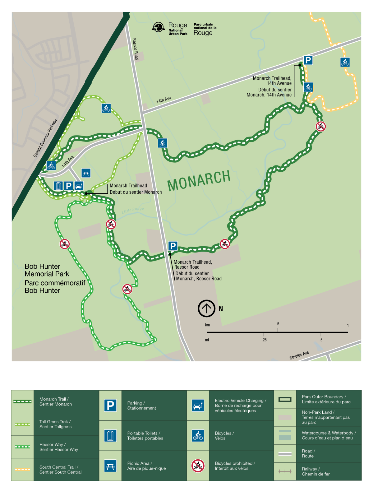
This gently rolling loop trail takes you through a mix of habitats from rare cedar savannah to adjacent farm fields and a restored stand of white pine. Year-round wildlife sightings, seasonal viewscapes and connections to the other Bob Hunter Memorial Park trails offer a new experience with each visit.
| Location |
7277 14th Ave, Markham |
| Difficulty | Moderate  |
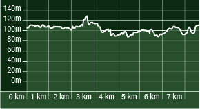
| Distance | 7.6 km |
| Time | 2 to 3 hours |
| Washrooms | Seasonally available near the parking lot |
| Parking | Limited free parking is available all year at 7277 14th Avenue |
Accessibility information

Surface: Crushed limestone, natural surface, asphalt, concrete
Average width: 160 cm
Minimum width: 90 cm
Average slope: 2.6%
Maximum slope: 17.8%
Average cross slope: 3.1%
Maximum cross slope: 15.7%
Trail Map

- Date modified :