
Smiths Falls Combined
Rideau Canal National Historic Site
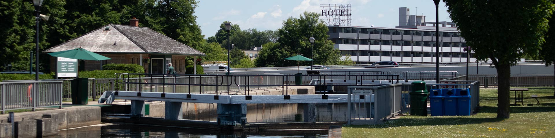
The Smiths Falls Combined lock is located in the heart of Smiths Falls. In 1974, a flight of three locks was replaced with a single “combined” lock having a lift of 26 feet, the single highest lift of any Rideau Canal lock. Full shopping facilities for visiting boaters are within walking distance. This location is a very popular overnight mooring area that has many spots with power available by a third-party service.
How to get here
Smiths Falls Combined
70 Confederation Drive
Smiths Falls, Ontario
GPS: 44°53'48"N 76°01'14"W
Phone
613-283-2103
Email
rideau@pc.gc.ca
Navigational data
- Distance from Ottawa: 96.8 km (60.2 mi)
- Distance from Kingston: 105.3 km (65.4 mi)
- Nautical chart: #1512 (Sheet 3)
- Lock length: 40.8 m (134 ft)
- Lock width: 9.7 m (33 ft)
- Average lift: 7.6 m (25.6 ft)
Facilities and services
- Overnight mooring (2 nights max)
- Washrooms
- Barbecue grills
- Potable water
- Shore power (third-party service)
- Picnic tables
- Visitor information
- Self-guiding trail
- Parking (limited)
History
This canal town is named for Thomas Smyth, a Loyalist who in 1786 was granted four hundred acres in what is present-day Smiths Falls. At the time of canal construction a small settlement had been established around a mill operated by a local named Abel Russell Ward. Colonel By ordered the removal of Ward's mill to make way for the canal.
Read more history about this lockstationGoogle Street View
Related links
- Ottawa Locks
- Hartwells
- Hogs Back
- Black Rapids
- Long Island
- Burritts Rapids
- Lower Nicholsons
- Upper Nicholsons
- Clowes
- Merrickville
- Edmonds
- Old Slys
- Smiths Falls Detached
- Poonamalie
- Lower Beveridges
- Upper Beveridges
- Colonel By Island
- Narrows
- Newboro
- Chaffeys
- Davis
- Jones Falls
- Brass Point Bridge
- Upper Brewers
- Lower Brewers
- Kingston Mills
- Date modified :