
Edmonds
Rideau Canal National Historic Site
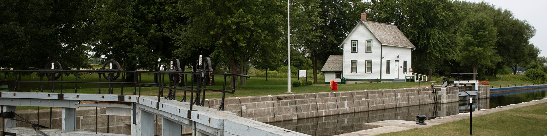
The Edmonds lock, weir, and stone arch overflow dam were built between the late 1820s and early 1830s. A stone lockmaster's house constructed at the site in the early 1840s was replaced with a two-storey house in 1905. Edmonds lockstation features considerable open greenspace and an abundance of trees. There is ample room for campers with plenty of parking and a boat launch.
How to get here
Edmonds
147 Edmonds Lock Lane
Merrickville-Wolford, Ontario
GPS: 44°52'39"N 75°59'01"W
Phone
613-283-4406
Email
rideau@pc.gc.ca
Navigational data
- Distance from Ottawa: 92.7 km (57.6 mi)
- Distance from Kingston: 109.4 km (68.0 mi)
- Nautical chart: #1512 (Sheet 3)
- Lock length: 40.8 m (134 ft)
- Lock width: 9.7 m (33 ft)
- Average lift: 2.8 m (9.2 ft)
Facilities and services
- Overnight mooring (2 nights max)
- Camping
- Washrooms
- Potable water
- Boat launch
- Picnic tables
- Parking
History
Edmonds lock was named after James Edmunds, one of the earliest settlers in this part of the Rideau Valley. For part of the 19th century, it was known as Mills Lock after its long serving first lockmaster, Edward Mills (1832-1867) and his son William W. Mills (1867-1897). Today, the lockstation is referred to as both “Edmonds” and ”Edmunds”.
Read more history about this lockstationGoogle Street View
Related links
- Ottawa Locks
- Hartwells
- Hogs Back
- Black Rapids
- Long Island
- Burritts Rapids
- Lower Nicholsons
- Upper Nicholsons
- Clowes
- Merrickville
- Old Slys
- Smiths Falls Combined
- Smiths Falls Detached
- Poonamalie
- Lower Beveridges
- Upper Beveridges
- Colonel By Island
- Narrows
- Newboro
- Chaffeys
- Davis
- Jones Falls
- Brass Point Bridge
- Upper Brewers
- Lower Brewers
- Kingston Mills
- Date modified :